Area development Zuidelijk Westerkwartier
In the Zuidelijk Westerkwartier, we are combining the development of balancing lakes with nature conservation. We are doing this in collaboration with the Groningen provincial executive. At the same time, we are implementing measures related to water quality, recreation, agriculture, landscape restoration, and quality of life. This ensures that residents can continue to live, work, and relax safely and comfortably in a future-proof area.
Current information
The most up-to-date information, newsletters, and reports from the regional meetings can be found on the region's own website: zuidelijkwesterkwartier.nl.
Newsletter Zuidelijk Westerkwartier
Would you like to stay informed? Then subscribe to the newsletter. Send an email to info@zuidelijkwesterkwartier.nl.
What is the challenge in the Zuidelijk Westerkwartier?
The climate is changing. As a result, the risk of flooding and water shortages in our region is greater. The consequences of this have been examined in a study.
- To combat flooding up to 2050, we need to take measures. Some of these will be implemented within the Zuidelijk Westerkwartier. The water authority has three important tasks in this regard:
- Keeping dry feet: this is achieved by constructing various balancing lakes. We can use these balancing lakes when there is exceptionally heavy rainfall, and the streams, canals, and ditches in our area are already full and we cannot discharge the water into the sea.
- Improving water quality: this means working to ensure clean and healthy surface water and groundwater.
- Improved water retention: this helps to limit the impact of drought, and reduces flooding during extreme rainfall.
- At the same time, the Groningen provincial executive also has an important goal within the Zuidelijk Westerkwartier: establishing the National Nature Network (NNN).
The provincial executive and the water authority implement measures for nature and water together as much as possible. This prevents duplication of work and double inconvenience for the residents of the area.
What have we done so far?
- Designing a balancing lake and nature area within "De Driepolders." In the balancing lake, we can store 1.3 million m3 of water temporarily in case of emergencies.
- Designing the balancing lake and nature area within the De Dijken-Bakkerom polder. In an emergency, the balancing lake an store 1.2 million m3 of water temporarily.
- Optimisation of the Lettelberterberg catchwater. The water inlets and outlets of the retention catchwater have been replaced. The retention catchwater now has a more natural design. This makes the area more suitable as a habitat for fish.
- Optimising water management in the Vredewold, Nienoord, Zuiderpolder, Fanerpolder (replacement of pumping station), Lagemeeden, and Lettelbert polders. We have adapted water management to the requirements of the National Administrative Agreement on Water (NBW).
- The regional flood defence Hoendiep has been reinforced. This reinforcement ensures that the polders behind it will remain dry even in extreme weather conditions in the future.
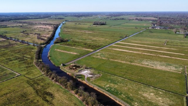
- The balancing lakes 'De Drie Polders” and 'Polder de Dijken-Bakkerom' are ready for use. The change in the landscape is clearly visible in the video below.
First step Dwarsdiep area: improving the water system near Marum
To address flooding and water shortages, we will be working on developing the Dwarsdiep stream system in the coming period. The project involves retaining 2.7 million cubic metres of water in combination with a natural stream design.
The final design for the development of the Dwarsdiep area as a balancing lake and nature reserve is complete. The Board of Directors of the Noorderzijlvest Water Authority has now granted the credit for the initial work. This means that in the autumn of 2026, we will begin implementing measures outside the balancing-lake area. We will first improve the water system in the Marum area. In addition, we are continuing to work on preparing the design of the area as a nature reserve and balancing lake.
What's going to happen in Marum?
We are improving drainage and water-level management around Marum:
- It is important to agriculture and villages in the area that water can be drained properly during heavy rainfall. That is why we are improving culverts south of the Marumerlage and near the Wilgepad.
- Two smaller weirs of the A7 will also be widened to improve water level management.
- Furthermore, the two larger weirs, the Balktilster weir and Ooster Liets weer, will be replaced and modernised.
- In addition, we will be working on nature-friendly riverbanks and fish passages.
Walk-in meeting on 30 March 2026
On 30 March, we presented the final design for the Dwarsdiep area to local residents and other stakeholders. At a well-attended walk-in meeting in Tolbert, they were able to ask questions about the design and the next steps. We also explained the work that will begin first. For example, we will replace culverts (concrete pipes) and weirs and start work on nature-friendly banks and fish passages. We also provided more information about the Wilgepad-Oost and Marumerlage-Noord areas. A report on the evening can be found on the website Zuidelijk Westerkwartier Area Development- Review of the Zuidelijk Westerkwartier walk-in meeting.