Monitoring network maps salt content of lake Lauwersmeer
14 July 2025
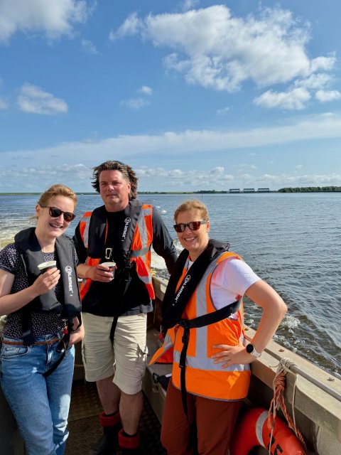
In the coming months, the Noorderzijlvest Water Authority will be launching a special project in the lake Lauwersmeer area: the construction of an extensive monitoring network to map the salinity levels. Why is this important, how does it work exactly, and what are the benefits? Hydrologist Meike Coonen and Johan Draaier, data and monitoring network management consultant, give us a glimpse behind the scenes.
A more natural lake Lauwersmeer
The Future Agenda for Lauwersmeer stipulates that the northern part of the lake may become more brackish in order to improve its ecological quality. At the same time, the southern part will remain fresh, which is important for agriculture.
We are studying how we can achieve a gradual transition from freshwater to saltwater between lake Lauwersmeer and the Wadden Sea," says Meike. "The new monitoring network is a first step in this direction."
Where is the salt?
Johan explains why measurement is so important:
We want to know where saltwater is located, how it flows and mixes with freshwater, and how we can drain it quickly again. To do this, we need reliable data.
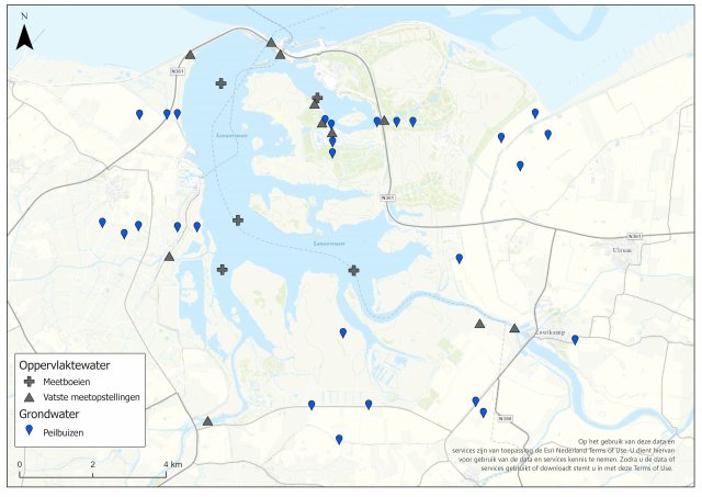
The monitoring network will consist of around fifty measuring points spread across the area. Some existing measuring locations will be reused, but many new ones will also be added. For example, monitoring wells for groundwater measurements, measuring buoys in the lake, and fixed installations on the waterfront. The measuring points will be located on agricultural land and in lake Lauwersmeer itself, among other places. We also want to install new measuring points in areas managed by Staatsbosbeheer (Dutch Forestry Commission) and on the De Marnewaard defence land.
Smart measurement, together with Rijkswaterstaat
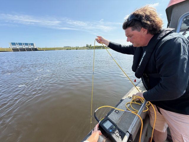
The water authority works together with Rijkswaterstaat to install measuring buoys in the lake. "They already have experience of this," says Johan. "For example, with measuring in navigation channels, where saltwater—which is heavier than freshwater—moves across the bottom. At some locations, we use a smart construction in which a sensor descends to the bottom on a guide rail. This prevents interference with shipping."
Suitable measurement locations are also sought at the Clevering locks. "We want to measure how much saltwater enters or is discharged there," explains Meike. "This autumn, we will organise a sailing measurement campaign together with Rijkswaterstaat to map flow velocities and chloride levels."
What are we actually measuring?
Although the project is known as a "saltwater monitoring network," the sensors actually measure the electrical conductivity (EC) of the water. In general, the higher the EC, the more ions there are, and therefore the saltier the water.
From data to insight
Data collection takes place over a long period of time and under various conditions. "Wind, drought, and management choices influence the spread of saltwater," says Meike. "That's why we take measurements in all seasons and at different depths."
The data we collect will provide us with a better understanding of how saltwater spreads in the area, as well as the extent to which this can be controlled. "With this information, we can also improve the models that predict what will happen if we allow saltwater in," says Johan. "This allows us to analyse different scenarios and study which solutions work well without disrupting other functions of lake Lauwersmeer. This then forms the basis for choosing the best options to achieve a natural transition from freshwater to saltwater."
More information
We are setting up a monitoring network to determine the salinity in and around the lake. This will enable us, and our regional partners, to learn more about the water system in the area. Read more about the saltwater monitoring network.