Task and measures for Peizerdiep
The Peizerdiep flows between the Sterrebos weir and De Onlanden. The stream valley and the surrounding area are being redesigned to make the natural environment more resilient to future challenges. An initial design for the area has now been completed and is being further refined with additional studies.
What is the assignment?
The Peizerdiep flows between the Oude Stuw in the Sterrebos and De Onlanden. The Peizerdiep is part of a broader stream valley system in the northernmost part of Drenthe that flows from the Fochteloërveen to De Onlanden. In this area, Noorderzijlvest Water Authority the Province of Drenthe are working to develop a future-proof water system. As part of this effort, we are improving water quality in accordance with the Water Framework Directive (WFD), designing the water system to better withstand both extremely wet and extremely dry weather conditions, and contributing to the development of the Dutch Nature Network (NNN). The measures focus on:
- Retaining water longer
We are enhancing the area’s “sponge effect” so that water is retained longer and can be released more slowly.
- Providing Extra Space for Water
Water storage capacity is being increased. By creating extra space for water in the Peizerdiep, peak discharge can be better accommodated.
- Restoring Natural Stream Dynamics
Where possible, natural stream dynamics are restored so that the stream can once again follow its natural course. flood embankments are also being flood embankments . Without flood embankments , the area behind flood embankment flood embankments flood flood embankment . This ensures a gradual drainage of water and reduces the risk of flooding elsewhere. This also enhances biodiversity by creating an alternation of wet and dry zones.
- Enhancing the landscape and the cultural landscape
Old landscape structures are being restored, for example by reintroducing vegetation and forests. This enhances the recreational experience for walkers and cyclists, in part by creating clear sightlines.
Project Area
Location
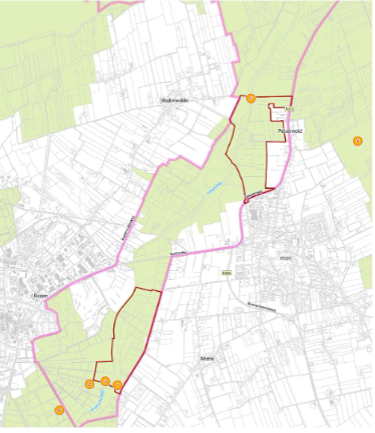
The project area extends from the Oude Stuw in the Sterrenbos near Roden to the bicycle bridge over the Peizerdiep near the Bommelier (north of Peize).
The redesign will take place in stages, with the design for the entire stream valley being further developed in phases. In Phase 1, we will develop two subcatchments:
- Weehorst (southern part)
- Stenhorsten (northern part)
Map of the project area
The map shows the entire project area. If for any reason you are unable to read the map, please contact the water authority atm.bolkestein@noorderzijlvest.nl.
What is the approach?
Redesign of the project area
A phased approach was chosen for the redesign of the project area. Within the boundaries of the Dutch Nature Network (NNN), a preliminary design was developed that consists of an initial phase and a long-term phase.
This approach makes it possible to work step by step toward the final development of the entire Peizerdiep stream valley, as outlined in the long-term design.
First phase
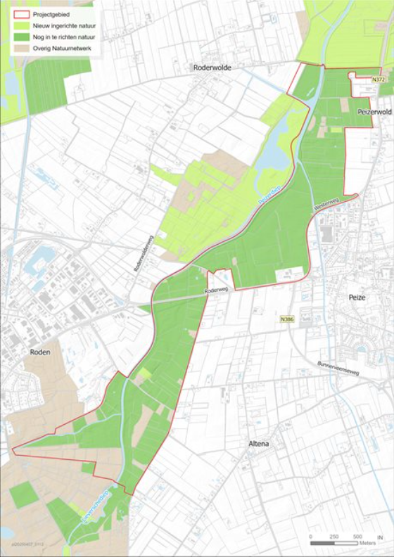
The first phase will begin with the Stenhorsten and Weehorst subcatchments. On the map, Stenhorsten is shown in the upper area outlined in red, and Weehorst in the lower area outlined in red.
Long-term phase
This phase will be detailed further.
Map of the Stenhorsten and Weehorst subcatchment
The map shows the Stenhorsten and Weehorst subareas. If for any reason you are unable to read the map, please contact the water authority atm.bolkestein@noorderzijlvest.nl.